Tour Te Waipounamu: New Zealand’s toughest bikepacking race?!
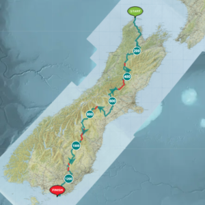
We’re excited to share some details about the inaugural Tour Te Waipounamu bikepacking race that starts on 14th February. There’s no doubt about it – this is New Zealand’s toughest bikepacking race. The 1350km route traverses the South Island high country from Cape Farewell in Golden Bay to Slope Point in the Catlins. In this blog we share some history of the race and more details on the route. In the next two weeks we’ll be introducing you to a couple of riders who have signed up for the adventure.
Race organiser, Brain Alder, has been dreaming up this route for ages. He has done an incredible job designing the route, especially securing access to many sections of private land to link up a varied, challenging route that includes lots of high country riding. He has had to adapt many parts of his plan A route along the way. For example, no organised events are allowed on the Barron Track from Upper Takaka to Flora Capark. In late 2020, after months of research and planning, he finally released a preliminary course. Keen bikepackers put applications in and 50 riders were selected to compete in the inaugural Tour Te Waipounamu race. Competitors have 14 days to complete the route but Brian expects the winner to finish in around a week.
Check out this article to learn more about Brian Alder and the sport of bikepacking: Uncertainty and excitement all part of the bikepacking revolution sweeping the world
Who are the riders?
There’s a lot of diversity in the field. There are some very accomplished bikepacking racers signed up, including previous participants and winners of many of the world’s toughest bikepacking races. Ollie Whalley, from Nelson, won the Tour Divide in 2012, setting a course record at the time. Brian Alder came 5th in the Tour Divide in 2016. Steve Halligan, based in Hanmer Springs, has been on the leading edge of any event he competes in. Another crowd favourite is Martin Strelka, originally from the Czech Republic but now based in Nelson. He only took up bikepacking a couple of years ago but has already won the Great Southern Brevet, the French Divide and the Bohemian Divide. There are also many first-time racers but experienced and passionate cyclists, like Hana Black and Mark Watson who spent a couple of years cycling around the world before the pandemic cut their trip short and they returned to New Zealand. Georgia Whitla is a top rogainer and well-known in the adventure racing scene in New Zealand. Meggie Bichard is an ex-pro mountain biker who raced on the EWS circuit for several years before retiring focusing on more varied outdoor adventures.
In the next couple of weeks we’ll be publishing profiles on a couple of people who have signed up for the event – people from totally different walks of life and with different goals for the race. You can learn more about their background in biking and other adventures, what their build-up has been like for the race and what their goals are for the Tour Te Waipounamu.
A teaser for a doco being made on the race!
Rob Dawson is making a documentary about the inaugral Tour Te Waipounamu race. Check out the five minute teaser below:
The route
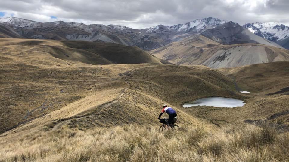
It’s a 1350km route with around 22,000m elevation gain that includes some particularly rugged sections, including at least 30km of hike-a-bike. The route traverses the South Island’s high country, that land between the plains and the Southern Alps with a reputation as a harsh, beautiful landscape. It crosses through more than 200 kilometres of private land that’s inaccessible to the public (on the tracking map you’ll see these sections are in red). For more details, check out the tracking map, which will track the race live from 14th February.
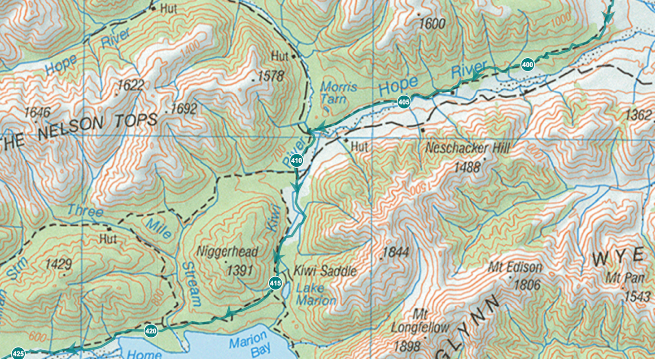
The toughest section of the race will probably be between Lewis Pass and Methven. Of course that’s likely to be weather dependent – if the weather is heinous elsewhere then it might be that section! After leaving the highway near Boyle River, the route follows the Hope River to Lake Sumner:
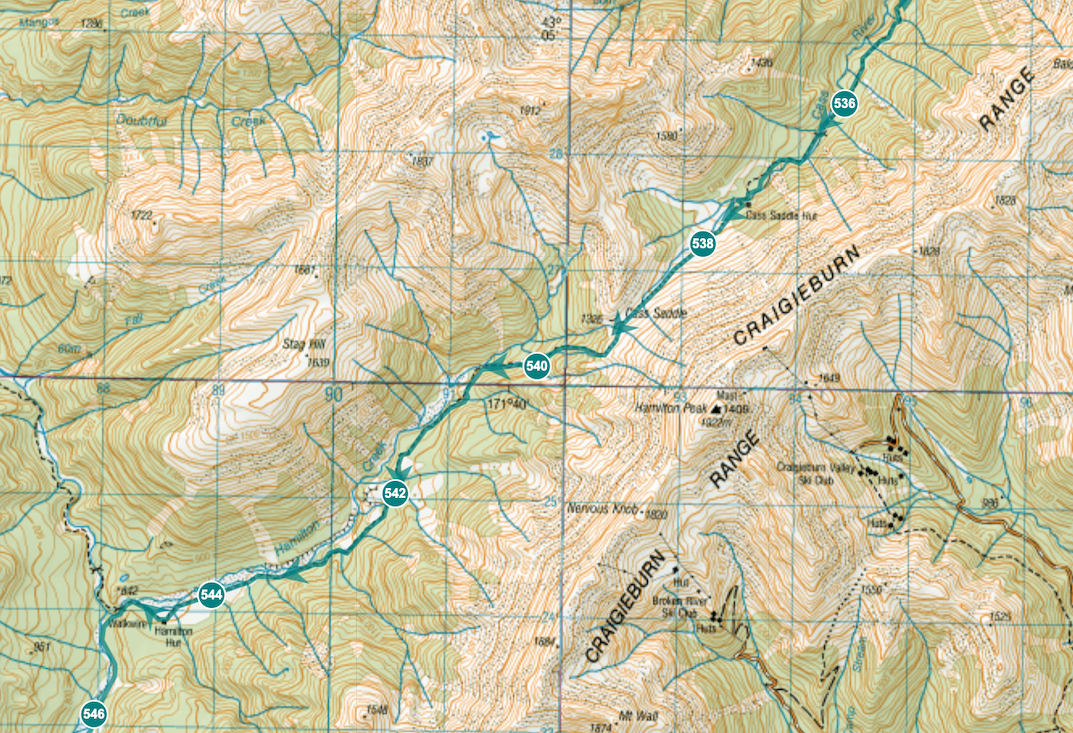
From Lake Sumner the route passes through around 80 kilometres of private land before reaching the Waimakariri River. From there they’ll continue through the Craigieburn Range, carrying bikes over the Cass Saddle and ‘riding’ down the Hamilton River before popping out at Lake Coleridge.
Supervalue and Four Square in Methven won’t know what hit them! In Methven racers will also pass the only bike shop on the whole route, just before heading into the Two Thumbs Range.
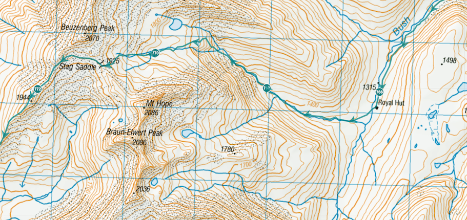
Race organiser, Brian Alder, expects the section through the Two Thumbs range to be one of the most challenging parts of the route. This section will have a lot of hike-a-biking, including the ascent to Stag Saddle, the highest point in the Te Araroa Trail (NZ’s thru-hike).
If the weather’s good, riders will be baking hot with virtually no shade. If there’s a cold weather system passing through, it will be freezing with no respite from the wind and rain. A couple of years ago I walked my packraft through this range in February and we had fresh snow and the saddle covered in ice! The view to Lake Tekapo will be a welcome sight.
After hitting the valley floor there’s a bit of flat ground as riders head towards Lake Pukaki. They’ll be stopping to stuff their faces with food at the Tekapo Four Square, and stocking up supplies for the burly 4WD section ahead. By the time they reach Lake Benmore hopefully they’ll have caught up on some sleep and the raspberry bun high may have worn off.
From Lake Benmore the burly 4WD roads begin! Again, virtually no shade. It’s hard to decide if this route would be worse in the baking sun or cold weather. From Lake Benmore it’s about 70km of private land before reaching the Hawkdun Range.
The route continues past Ida Valley, Poolburn, Lake Onslow and to the Clutha River around Beaumont. From here it’s the home stretch – only 200km to go! By now fatigue will have well and truly set in but the buzz of finishing will provide a final burst of motivation. Riders will be happy to have the hard hills and hike-a-biking behind them and be able to just focus on turning the pedals. By the time riders reach Slope Point in the Catlins they will have completed around 22,000m of elevation gain.
The Pedal on Podcast: Tour Te Waipounamu
Check out this episode of the Pedal on Podcast to learn more about the race. It includes interviews with a couple of people competing in Tour Te Waipounamu. In the next week or two they’ll be releasing another episode, checking in with the same people interviewed. You can find Pedal on Podcast on all the main podcast apps.
How to follow the race
- Live GPS tracking on MAProgress starts on 14th February. You can check out the route on the tracking map from today! You’ll see some of the riders who are already signed up to tracking – the rest will trickle in over the next two weeks. Note that the red sections on the tracking map show PRIVATE land.
- Public Facebook page: Tour Te Waipounamu
- Instagram page: Tour Te Waipounamu
- You can also expect to hear some race commentary via Dot Watcher – we’ll share more about Dot Watcher later.
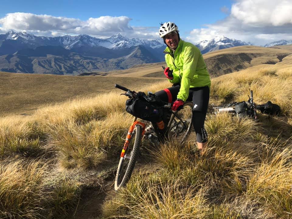
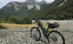
The photos in this blog are from Andrew Trevelyan, who is signed up for the race. You’ll be hearing more about Andrew (and the training mission he went on in the Two Thumbs Range with his mate Rob) in our next blog update on the Tour Te Waipounamu.
Pedal on!

